Follow Our Trip

Welcome to the Travel Blog! We'll try to update everyone on our trip, things we've seen and done, and include cool photos when possible. Feel free to leave us messages, and we're always looking for tips on places to go next!

Thursday, July 28, 2011

Time to Move East-er

Well it was inevitable. We're sort of sick of driving around the west coast. It's beautiful and all, but at a certain point you don't really want to see more of the Cascades from your tent/car. We've started saying things like "this looks just like Olympic only drier" and "this is just like Rainier (or insert other mountain)" and other banalities. Time for a change. So we're halting the southward progress and turning east.

After our stop south of Crater Lake, we drove east through the Oregon Outback (named thus by the helpful "scenic byway" signs on the only road available). More high desert: cattle country dotted with irrigated farms. It's pretty in its own way, but not a place we'd like to spend a lot of time just the same. There were even some dunes; who knew Oregon had so many? We did pass several shallow and seasonal lakes, very salty, and drove along the Malheur River for awhile. The river valley was full of small farms and secluded houses. Again, very pretty. Again, not stopping. We passed several "towns" which consisted, so far as we could tell, of depressingly singular things such as: a highway maintenance station (Alkali Lake), a billboard saying "you just missed it!" (Riley), or a closed motel (don't remember that town name). We did stop along the way for a late lunch at a classic country diner. Hilary insisted on getting the chicken fried steak, having never eaten such a delicacy before. The all-day-breakfast order consisted of the chicken-fried steak floating on and topped with white gravy, two eggs, three pancakes, and two rolls. For balance we also split a salad. We did not eat dinner later.

Wound up in Ontario, Oregon. Got ourselves a motel after the longest, by far, driving day yet (400 country road miles). It's a little sad since on our way west in 2004 we drove about 1000 miles in one day, through the pouring rain and towing a U-Haul, from Philadelphia to Milwaukee. Apparently we're getting old. Time to buy an RV and turn in the tent. The Ontario Inn we found based on billboard directions is great! The room is big and clean, there's a fridge and microwave, continental breakfast, friendly staff, and a fuzzy grey office cat who loves people. Got a bottle of wine to sip while we just sat in the bed. Nothing like a week in a tent to make you appreciate a bed.

We'll head across the river to Idaho today and take our time moving up through the forests and canyons. Map Link.

Eastern Oregon Cascades

We hit firmly on the eastern side of the Cascades after Mt Hood. We could finally tell it was quite a bit drier. That feeling eventually turned to glum acceptance, but at first it was kind of nice. We drove down through the high desert, stopping for lunch along the very windy Deschutes River outside Warm Springs. We stopped at a park north of Bend, and for the first time got skunked on a site. Apparently this area is popular, even during the week. So we kept going south, stopping for a beer and snacks at Deschutes Brewing. The bar was very crowded and we honestly liked Full Sail better for the ambiance, food, and beer. We did make a pilgrimage to Mirror Pond, however, out of respect.


After we left Bend, we found a camp site at La Pine state park. In the park was the largest Ponderosa Pine ever recorded. Apparently we're a bit jaded on the big trees, as our comment was "huh, big tree" and we didn't even bother with a picture. The camp was pretty good, though rather cold at night as it is in the desert. In the morning we hiked along Fall River, an offshoot of the Deschutes, and eventually found the falls after much side- and back-tracking.

We drove south again through the desert, turning west along the (thankfully open) road to Crater Lake. Most of the hikes to viewpoints were closed, but the rim road and north entrance were open to traffic. We drove the long way around the lake, stopping often for views. We tried to go to Cloudcap, but the road was eaten by snow about 500 ft from the rim road. We made a side trip to the Lost Creek campground and almost got a site, but were chased away by the gimongous mosquitoes. We finished the loop around the lake and continued south to look for a campground. After a short stop at a primitive camp populated mostly by flyfisher-men, we settled on Collier State Park. Best park ever! In addition to hot showers, there was a laundry room that was not exorbitant. We also met a couple from Merced at the end of their 2-month road trip and shared the last bottle of 2006 Orange Blossom mead with them (been dragging that thing around for too long!). They brought us a real axe to split our wood (after laughing at Hilary and the hatchet) and even fed us. Best park ever!

Monday, July 25, 2011

Week 2 Stats

Week 2 is over already! Here are the stats:

Miles driven: 1066.9
States/provinces visited: 3
Trails/roads snowed in: 2
Old friends seen: 2
Meals stretched out of Vancouver dining: 5
Viruses battled: 1 (contest not yet decided)
Car repacks due to leaking cooler: 2

The second week was a learning experience. The trip is not going to play out like we expected at first, but that is ok. We are going to skip some things, and do more hanging out in one place. Pitching a tent every day gets old fast. Also, more visiting national forests and less battling strollers and children in national parks. Families are nice and all, but they sure are slow on the trails.

Mt Hood, Portland, Hood River

On Saturday we drove to Portland. We met Sara and Audrey for beers and munchies, our first "see old friends" stop of the trip. It was great! After two weeks of just the two of us, it was so nice to hang out with people at a bar in a city and feel a little bit like "normal". We'll probably rearrange our trip going forward to have more people in it, even though we do like the nature stuff too.

Sunday we spent randomly driving around Mt Hood National Forest. The ranger station was closed and we had no map, so we just picked a road and drove. We stopped at the Dog River trailhead for a ~5 mile hike up along the streambed. The folks we met at the bottom before and after the hike said it was mostly a mountain biking trail, but we only saw one hiker while we were walking. It was pleasant walk, though we had to cut it a little short since we didn't bring enough water for a longer hike.


After we came back down, we decided to keep driving toward the peak. We turned off randomly to the east (away from Mt Hood) since it seemed like a good idea and there was a suggestive sign about an alpine meadow. Unfortunately after that the signage was damaged, removed, or just plain wrong. We wound up on some roads that we couldn't continue along due to the rocks and trees along them, and wound up backing down two roads since we couldn't turn around either.
After a while of the back and forths, we just parked the car along some random trail and started walking. We found a sign, maybe someone can figure out where we were?


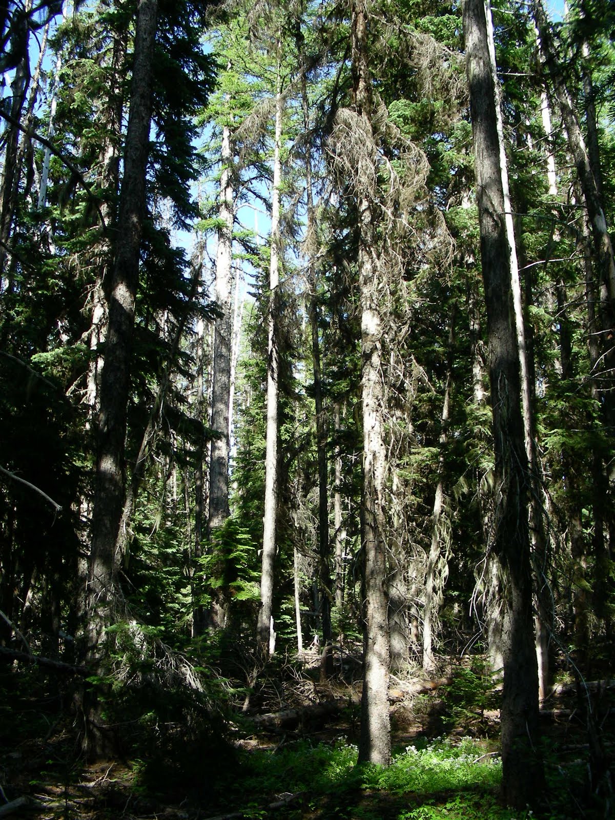
Three miles from the Fifteenmile Campground. Ok, sounds good. We did see a biker on the trail, so it must not have been too far in the middle of nowhere. The forest was very strange. The trees were all, or mostly all, dead. No fire damage, just dead trees. Not sure what that was about, but it made for an interesting looking forest. After some walking, we did find a meadow; must have been that one the missing signs were pointing to. The dead trees allowed lots of groundcover flowers to bloom, very pretty.


On our way back we got a few pictures of Mt Hood. Gotta say, Mt Hood is just prettier than Mt Rainier. Oregon wins again! Stopped in Hood River and wandered around until we found Full Sail. Got a beer sampler, a beet salad, and the beer/cheese soup. Yum! Watched the kite and wind surfers scoot along the river. Hood River would be a nice place, we should move here. Map Link.

Back to Oregon

So far we love Oregon the most. Washington was nice and all, but Oregon is great. My only big complaint is the full-serve gas. At least this time through we didn't even try to get it ourselves and avoided the chastisement of the station attendants.

We drove down a forest road which took us past Mt St Helens. The road to an overlook near the peak was closed (snow again), but we got some spectacular views just the same. We also finally got a view of Rainier without too much cloud cover. The weather finally seemed to be summery, which was a welcome treat after a week and a half of cool, rain, and clouds.

We zig-zagged out of the forest and wound up along the Columbia River. We crossed at the Bridge of the Gods, though didn't stop to figure out why it was called that. Looked like a bridge, and cost $1 to go across. The Columbia River Gorge is beautiful, perhaps our favorite view of the trip so far. We drove east along the gorge and stopped at Viento State Park, arriving just before the weekend visitors ate up all the available spots. Hung out on the river bank, stopped in Hood River for a few supplies and to spray some of the dirt off the car. The forecast called for 80s and sun, a miracle!